 |
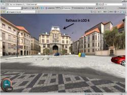
Cities are increasingly being visualized even up to street level from a pedestrian's perspective. This way many more details in Mirror Worlds can be shown as compared to high level satellite data. Applications are interactive 3D navigation devices or social community applications where the virtual world strengthens the community aspect of the real world.
To get the data of buildings (architectural CAD data is not widely available) and the visualization via photo mapping is still a technically complex matter for application developers. Some concepts require arranging data collection from end-users and editing it by themselves. For this purpose the ISO standards VRML and X3D as well as the industry standard KMZ based on the COLLADA standard are used worldwide. All of these standard formats are supported by the visualization component BS Contact Geo.
